


LITTLE FALLS - T 2 Voting District, Monroe County, Wisconsin
About
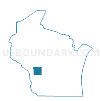
Outline

Summary
| Unique Area Identifier | 695663 |
| Name | LITTLE FALLS - T 2 Voting District |
| County | Monroe County |
| State | Wisconsin |
| Area (square miles) | 22.56 |
| Land Area (square miles) | 22.56 |
| Water Area (square miles) | 0.00 |
| % of Land Area | 100.00 |
| % of Water Area | 0.00 |
| Latitude of the Internal Point | 44.08235060 |
| Longtitude of the Internal Point | -90.82001850 |
Maps


Graphs
Select a template below for downloading or customizing gragh for LITTLE FALLS - T 2 Voting District, Monroe County, Wisconsin


Neighbors
Neighoring Voting District (by Name) Neighboring Voting District on the Map
- LAFAYETTE - T 1 Voting District, Monroe County, WI
- LITTLE FALLS - T 1 Voting District, Monroe County, WI
- MANCHESTER - T 1 Voting District, Jackson County, WI
- NEW LYME - T 1 Voting District, Monroe County, WI
- SPARTA - T 2 Voting District, Monroe County, WI
- SPARTA - T 3 Voting District, Monroe County, WI
- SPARTA - T 4 Voting District, Monroe County, WI
Top 10 Neighboring County Subdivision (by Population) Neighboring County Subdivision on the Map
- Sparta town, Monroe County, WI (3,128)
- Little Falls town, Monroe County, WI (1,523)
- Manchester town, Jackson County, WI (704)
- Lafayette town, Monroe County, WI (396)
- New Lyme town, Monroe County, WI (168)